
| – Rabin Lamsal |
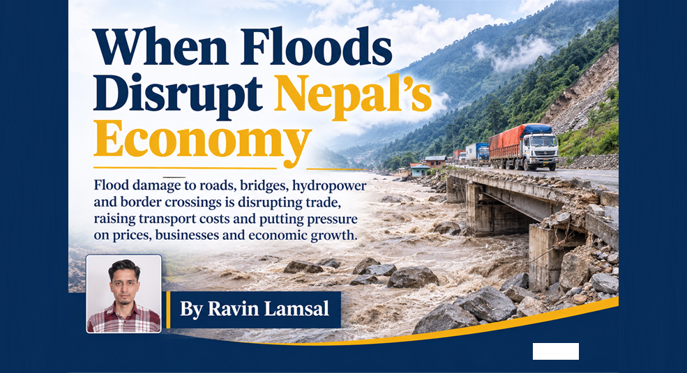
Recent floods on the Bhotekoshi-Trishuli and Kaligandaki rivers have damaged roads, bridges, power plants and border crossings. Their effects are now reaching prices, trade and economic growth across the country. On 26 August 2026, a flash flood that had crossed the border from China into Nepal at Rasuwagadhi was devastating. The Gyirong port on the Chinese side was submerged, while several places along the Bhotekoshi and Trishuli river in Nepal were affected by the wave that had traveled 72 kilometers downstream. The Authorities alerted downstream communities as far as Chitwan.
A month later, on Sunday 27 September, another river turned into destructive. The continuous four days rain lead to a devastating flood in Kaligandaki that burst its banks at Farse in Parbat district and swept away around 80 houses. The same flood also swept out a motorable bridge that connects mirmi of Syangja and Harmichaur of Gulmi.
The two disasters were very different in where they started and how big they were. The first began high in the mountains and is considered one of the most destructive floods in the region’s modern history. The second was caused by days of relentless monsoon rain. But they follow the same pattern. Climate-driven disasters are destructing the roads, bridges, power lines and border facilities that Nepal relies on to import essential commodities from china. The Bhotekoshi Flood affected Rasuwagadhi naka while Kaligandaki flood disturbed the way to Korola Naka. The damage doesn’t stay put. It spreads into prices, trade and public finances.
Nepal’s topography makes it extremely vulnerable to disasters as the mountains are steep and slippery. Moreover, the country’s rivers are very long and drop rapidly from the height of the Tibetan Plateau into the Indian plains. These rivers carry large amounts of rocks, gravel, and sediment downstream. The warm season is the rainy season in Nepal. The consequence of prolonged rainfall is that the slopes of mountains become saturated with water, leading to landslides and river floods.
Furthermore, the process of glacial retreats leads to the formation of lakes and accumulations of rocks in the ground, which are high above the valley. The collapse of such formations can lead to significant disasters in the downstream area. Moreover, the flow of water from the glacier is very strong and swift, destroying everything in its path. The danger is compounded by the fact that many settlements and infrastructures are built on the bank of rivers. In addition, the risk of disaster is aggravated by the fact that in Nepal, the most economically viable land is a river valley with a view of water sources. A similar disaster to the one that occurred in Nepal in 2026 is entirely possible. On 8 July 2025, a flood of glacial meltwater from a supraglacial lake in the upper reaches of the Bhotekoshi river in Tibet was observed. The Miteri Bridge, connecting Nepal and China, was washed away. Moreover, the dry port under construction in Timure was destroyed, nine people were killed.
The August flood destroyed the Rasuwagadhi customs office, the immigration post and the Miteri Bridge, and it swept away more than 1000 vehicles including hundreds of cargo trucks, electric cars and containers queued at the border crossing. Timure Bazaar, the first settlement in the flood’s path, was largely washed away. Syabrubesi, the gateway town for the Langtang trekking region, sustained extensive damage, and the flood affected Rasuwa, Nuwakot, Dhading, Gorkha and Chitwan districts.
Lots of people lost their life. Media and agency tallies of deaths and missing persons have changed repeatedly since the disaster, and one running compilation lists more than 1,400 deaths and over 5,700 missing in Nepal. The energy minister told reporters on 23 September that more than 800 people remained missing from hydropower projects alone, many of them in tunnels and construction sites along the river.
The flood also damaged the tools designed to reduce disaster risk. Four river-monitoring stations, at Bhote Koshi and Syabrubesi in Rasuwa, Betrawati in Nuwakot and Malekhu in Dhading, were destroyed by the flood. A preliminary Rapid Damage and Needs Assessment found that 7,570 private houses were completely destroyed, directly affecting 8,317 households. Sections of the Prithvi Highway were blocked, which delayed in rescue operations and the movement of goods, fuel, food and peoples. Sections of the Pasang Lhamu Highway, the main road from Kathmandu to Rasuwa and the Langtang region, were also closed.
The Kaligandaki flood in september was smaller, but it illustrates how ordinary monsoon extremes can affect the similar networks. Around 8 am on Sunday, floodwater entered the Farse settlement in Jaljala Rural Municipality-8, where about 80 houses stood. Early reports from the Armed Police Force counted 66 houses swept away, and later reports raised the figure to 80. Another 23 houses were described as at high risk. Residents had been moved to safe place in time, and no casualties were reported at the settlement.
The flood also cut a transport link. The motorable bridge connecting Mirmi in Syangja and Harmichaur in Gulmi was washed away, disrupting travel and transport between the two districts. Floodwater swamped Setibeni Bazaar, where the borders of Syangja, Parbat and Gulmi meet.
Nepal has built its energy strategy around hydropower, and the recent floods exposed the risks of that concentration. After the Bhotekoshi disaster, the Nepal Electricity Authority confirmed damage to six major hydropower and transmission facilities, including Rasuwagadhi, Chilime, Trishuli 3A and the Trishuli 3B substation. The government’s preliminary assessment later counted 13 hydropower projects with a combined capacity of 783 megawatts, along with a solar plant and two transmission lines. About 431 megawatts were removed from the national grid, according to the electricity authority. The Asian Development Bank put the figure at roughly a tenth of installed capacity. Analysts have noted that a further 470 MW of projects under construction were also affected. Losses of this kind matter beyond the plants themselves. The Diplomat reported that the outage comes as electricity demand is expected to rise in the dry season, and reduced domestic generation increases reliance on imports.
The Kaligandaki flood added to the strain. Heavy rain, floods and landslides damaged transmission towers along the 220 kV Kaligandaki Corridor, disrupting around 200 MW of generation. Towers 21 and 22 on the Dana-Kushma section were structurally damaged, and faults were recorded on the Kushma-New Butwal section. Repair teams struggled to reach tower sites because rain and landslides had blocked access roads. Damage to roads thus slows the repair of every other network.
The clearest link between infrastructure damage and supply chains is Rasuwagadhi, the main
overland crossing with China. In fiscal year 2082/83, the border point handled imports worth Rs 45.73 billion and exports of Rs 894.6 million, even though it operated for only six months. That was 2.18 percent of Nepal’s total foreign trade. In the previous fiscal year, imports of Rs 85.23 billion accounted for 4.72 percent.
The timing of the flood magnified its effect. It came just before Dashain, Tihar and Chhath, when demand for consumer goods peaks at its highest point. Ram Hari Karki, president of the Nepal Trans-Himalayan Border Commerce Association, said 500 to 600 Chinese containers carrying festival goods were travelling toward Kerung, many of them stuck after the border was damaged. More than 200 Nepali containers were swept away, and traders have to face the losses not less than NPR 2 billion. One car distributor alone lost about 100 electric vehicles worth 450 million rupees.
Alternative routes exist but are poor substitutes. Traders have diverted some cargo to Korala, a high-altitude crossing in Upper Mustang. Karki described it as a compulsion rather than an alternative, citing its difficult terrain and altitude. A round trip between China and Nepal via Korala takes at least 10 to 12 days, and moving cargo from the border to Kathmandu costs about NPR 450,000 to 500,000 per vehicle, an increase of 10 to 15 percent transport cost. The other main crossing, Tatopani, has been closed to trade since 29 August after China cited landslide risk.
The 2025 experience shows how long such disruptions can last. About 100 container trucks crossed at Rasuwagadhi each day before the July 2025 flood. Afterward, trade stopped entirely and did not resume until 1 January 2026. According to a Stimson Center analysis of Nepal’s customs accounts, trade through Rasuwagadhi fell 95 percent in the following six months, from $302 million to $15 million. Korala absorbed $87 million, a partial offset. Trade through Birgunj, the largest India-facing customs point, rose 59 percent from $2.0 billion to $3.2 billion, which suggests that lost northern trade was largely rerouted south.
For Nepal, this has strategic significance. Since India’s 2015 border disruption, Kathmandu has sought to develop links with China as a second option for trade. Repeated closures at Rasuwagadhi show how climate risk can undermine that diversification.
The impact reaches households and firms through several channels.
First, prices. Imports account for about 35 percent of GDP, and private consumption makes up about 82 percent, according to the National Statistics Office. Higher freight costs and delayed shipments therefore pass quickly to retail prices. The Asian Development Bank raised its 2026-27 inflation forecast for Nepal to 5.3 percent on 23 September.
Second, growth. The bank also cut its growth projection to 4.1 percent from 4.5 percent, attributing the change to flood damage to transport, hydropower and productive assets, and to knock-on effects for trade, tourism and agriculture. It put preliminary tourism losses at Rs 52.67 billion. Third, businesses. Freight firms, customs agents, hotels, warehouses and retailers along the Trishuli corridor have lost stock, vehicles and premises. Insured companies may struggle to document their losses because floodwater destroyed customs agents’ offices and records. For uninsured small firms, the consequences are more direct. Local economic centres such as Syabrubesi, Betrawati and Trishuli had been growing through tourism, trade, transport, agriculture and hydropower investment, and their destruction risks reversing years of progress.
Early estimates of total damage vary widely. The government’s preliminary figure is 200 billion rupees, or about $1.3 billion, while some analyses suggest losses above $5 billion. The gap reflects how early the assessments are and how difficult it is to value indirect losses such as lost trade, delayed investment and reduced tourism.
Research on earlier Nepali floods suggests the effects can persist. A study of a flood in the southern plains found that official assessments missed much of the damage, that cash wages fell by 9 to 10 percent and that households took on new debt, with effects lasting about a year.
Hazard alone does not explain the scale of these losses. Four structural factors contribute. The first is concentration. Border facilities, dry ports, hydropower plants, substations and highways sit close together in narrow river corridors, so a single surge can damage many assets at once.
The second is dependence on a few routes. When Rasuwagadhi fails, traffic shifts to crossings that were never designed for that volume, and when a second crossing closes, the system has little spare capacity.
The third is repetition. The same corridor was struck in 2025 and again in 2026, and rebuilding in the same exposed locations without redesign carries recurring risk.
The fourth is weak monitoring and financial protection. Early-warning stations were destroyed in August, and insurance coverage among small businesses is limited. Losses therefore fall largely on households and firms.
Authorities have acted on several fronts. The Nepal Electricity Authority has sent technical staff, equipment and repair materials to damaged sites as road conditions allow, and is restoring supply through alternative feeders where possible. The government completed a preliminary damage and needs assessment within weeks. On 28 August, Nepal reversed an earlier position and agreed to admit a limited number of foreign specialists from India, China, Australia and South Korea to help with tunnel rescue, DNA testing and forensic work. At Farse, local officials and security forces evacuated residents before the water arrived, which prevented casualties. Several gaps remain. Analysts at the Institute of South Asian Studies have pointed to the absence of institutionalized Nepal-China mechanisms for managing cross-border environmental risks, a notable gap given that the August flood began near the border. Other gaps include limited redundancy in trade routes, incomplete early-warning coverage, and thin insurance protection for small businesses. Rebuilding also raises design questions, since restoring facilities in the same locations exposes them to the same hazards.
The Bhotekoshi-Trishuli and Kaligandaki floods both happened around the same time of year, a month apart, but were vastly different in scale. They both highlighted the vulnerability of systems that the Nepalese economy relies on to climate-related disasters. When a border crossing was damaged, importing goods became harder, both in terms of costs and the timing of supplies arriving. When a transmission line was damaged, the electricity supply could be diminished. Similarly, when a bridge was lost, it could sever a lifeline between different districts, both in terms of people and goods. The effects of a disaster on a transport corridor do not remain confined to the disaster area. They can cause an increase in prices, a reduction in government revenues, and a loss of business confidence. The 2025 and 2026 events suggest that such a disruption has become a frequent economic hazard. With glacial and monsoon-related disasters looming ever larger, how Nepal invests in protecting, planning, and diversifying its transport and energy corridors will determine the economic cost of future disasters.